The Chaddock Level: Boothstown’s Underground Canal
This web site has a page about the importance of coal mining and the Bridgewater Canal in shaping the local landscape. It describes the construction of fifty miles of underground canals from Worsley to connect the coal reserves with the Bridgewater Canal.
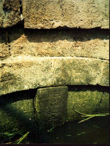
A similar feat was undertaken in Boothstown with the construction of the Chaddock Level. This was an underground canal which extended over 6,000 yards from the Bridgewater Canal, south of Boothstown to the Chaddock colliery, and beyond to the Queen Anne pit (which operated from 1810 to 1820) and the Henfold pit. The Chaddock Level was used to transport coal during the 19th century, and though precise dates of construction and disuse are unknown, the keystone on the entrance is dated 1816 (pictured here).

This entrance may still be seen, though it is often submerged under the water of a pond that has formed in front of it. Before there was large-scale housing development in the proximity, the pond was hidden among the scrub, and was enjoyed by those who had discovered it. One of the new streets off Amberhill Way was named The Chaddock Level.
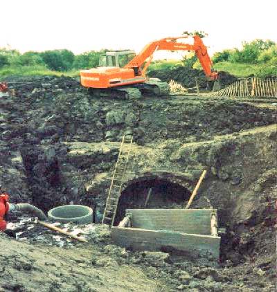
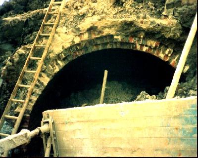
The tunnel of the Chaddock Level crosses under Amberhill Way at an angle of about 90 degrees, just past the last house on the canal side of the road. During the construction of new housing in 1993 the Chaddock Level itself was exposed, as the main sewer was laid quite deep along a line that is now Amberhill Way. When the sewer was being installed a section was cut out of the tunnel. The broken ends of each side were sealed by sheet piling with a small pipe joining each side to release any build-up of water.
The photographs below were taken when the tunnel was exposed in 1993. The double brick arch can be seen clearly.


It was not the first time the tunnel had been breached. Local historian Ken Hardman reported that in 1952 workmen broke into its roof when laying new sewer pipes in Vicar’s Hall Lane. At that time, before flooding caused the tunnel entrance to become submerged, it was possible to gaze into the brick tunnel. Ken Hardman’s pamphlet also includes the following:
A local man I spoke to, who still lives a short distance from the entrance, told me of how, when a boy in the 1950s, he had gone with a friend in a home-made canoe up the level for quite some distance. It divided into two some way along, and there were ventilation shafts every hundred yards or so. However, discretion overcame valour, and they sailed back before reaching any obstruction.
There are no known plans to preserve the tunnel entrance and its keystone. Many have expressed the view that it should be saved as a reminder for future generations of the labours of so many navigators, miners and canal workers. At least the tunnel entrance remains, having survived the redevelopment of its surrounding area in recent years. Perhaps it will remain undisturbed for many more years to come.
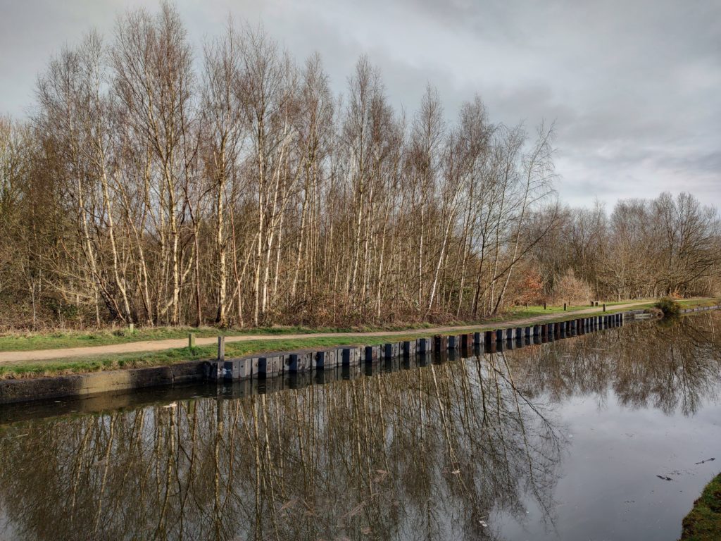
This map from the OS One Inch 1885-1900 Outline map series shows the link from the Bridgewater canal into the Chaddock Level. In the maps from the 1940’s this branch had been blocked off but the little basin remained until at least the 1970s. The basin has now been filled in but the position of it can be seen by the steel shuttering canal bank, the small concrete posts along each side of the old basin and the copse of silver birch trees.

Acknowledgements
This web page was written by Tony Smith. The photograph of the entrance to Chaddock Level is © Tony Smith. The photographs of the exposed Chaddock Level were kindly supplied by Dennis Beirne © not to be reproduced. Dennis also supplied information on the breach of the tunnel in 1993. K.R. Hardman’s pamphlet Chaddock Colliery (Engine Row) and Boothstown’s Own Navigable Level, was published by the City of Salford Arts and Leisure Department in 1994. The map is reproduced with the permission of the National Library of Scotland under the Creative Commons Attribution (CC-BY) licence.
Last updated March 2022